

Collect kilometres - collect experiences!
Visegrád and its surroundings are criss-crossed with beautiful hiking trails. It's no coincidence that professional athletes - cross-country runners, mountain bikers and even high-mountain expedition climbers - come here to train. The Pilis and Visegrád Hills are a real highlight of our country: their wild landscapes are a magnet for visitors. Beginners and experienced hikers alike can choose from a wide range of routes, but those who prefer half-shoe hikes can also set off on a small but spectacular adventure, for example on the To the Zsitvay Observatory.
The Danube Gorge shows itself on almost every hike in the area, its scenery refreshing and giving you the energy to continue. The Prédikálószék offers one of Hungary's most beautiful panoramas; the path up from the Szentfa chapel is full of exciting rocky sections, and it's nice to rest at the Wild Stones and then have a snack at the top.
The walks are sorted by difficulty level, with the level time (at a comfortable walking pace) and the elevation gain as an aid. The easy walks are a few hours' hike, the medium and longer walks take half a day to a full day. Click on any tour for a detailed description and map.
Easy, short hikes
2-4 hours - for families with preschoolers, school children, occasional hikers, older people

The blue lane from the Visegrád-Nagymaros ferry ( ), we follow the sign for Citadel in the direction of. Leaving the Citadel and arriving at the parking lot at the Nagyvillám, take the blue boulevard sign (
 ), which is indicated by the blue triangle (
 ) and the blue cross (
 ) goes together. Leaving the Nagyvillám ski slope, the blue cross () is highlighted, the blue triangle () and the Blue Route () and after about 500 m you will reach the Jurta camp. The Red T (
 ) is indicated by the letter, 10-station nature trail. The first stop concerns the Mogyoróhegy Wildlife Park, in good weather you can enjoy the panoramic view of Börzsöny and Szentendre Island (station 5), or take a rest on the shore of Lake Nádas (station 8). To the Zsitvay Observatory or the To the Citadel), but the blue rectangle (
 ), on the picturesque Áprily Valley via Visegrád-Szentgyörgypuszta.
During the summer time, on days off and public holidays, it is possible to return to the ferry and Szentendre by the Volán buses stopping at the Jurta camp. Before departure it is recommended to check the timetables.hu check the page. To the trail from the Pilis Parkerdő website downloaded from a sketch map with interesting facts and playful exercises.
Hiking map: the Visegrád-Nagymaros rév - Mogyoróhegy trail
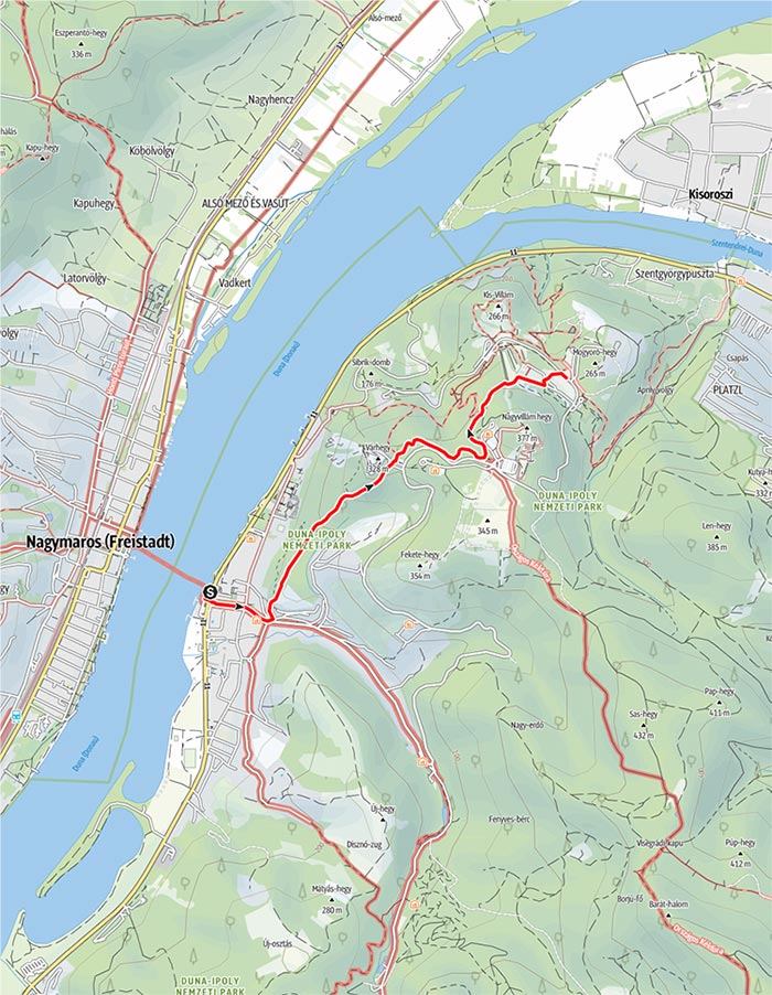
Source: termeszetjaro.hu tour planning app
The easiest way to reach the Apátkúti Valley is to follow the red lane from the Visegrád-Nagymaros ferry ( ). On a pleasant, level road, easy to walk for younger children and older ones, you will reach the Telgárthy gorge where you can choose from a wide range of activities and attractions.
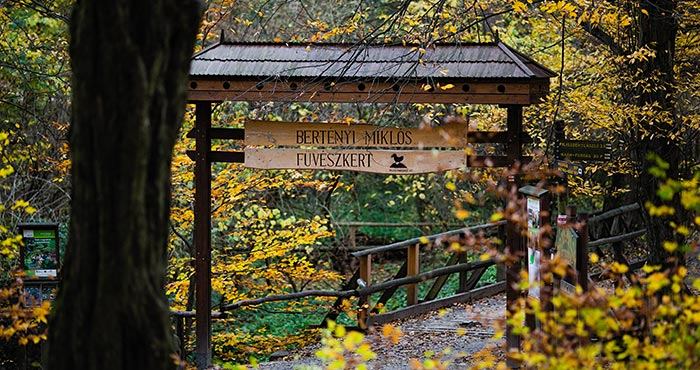
The meadow is equipped with a rain shelter, a fire pit and a playground for the little ones. Next to the meadow is the Bertényi Miklós Artist Garden, and the Mother Forest Nature Trail is. At the Trout Lakes near the valley you can for trout fishing, or for consumption at the nearby Ördögmalom Forest Restaurant.
After visiting the sights, the red bar () to Pilisszentlászló, or take the green cross from the restaurant ( ) to reach the return route to the meadow, marked by the green bar (
 ).
).
Hiking map: the Visegrád-Nagymaros rév - Telgárthy-ree (Apátkúti Valley)
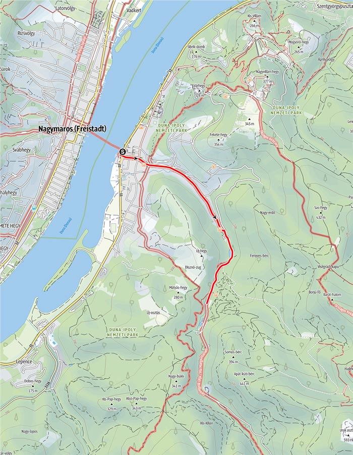
Source: termeszetjaro.hu tour planning app

The blue lane from the Visegrád-Nagymaros ferry (), we follow the sign for Citadel in the direction of. After visiting the Citadel, a short walk on the blue lane will take you to the Nagyvillám parking lot, from where you can take the Zsitvay Lookout the blue triangle (). From the lookout you have a wonderful view of the Danube bend and the Börzsöny. From here, follow the blue triangle back to the parking area and then the blue cross () - blue triangle - blue circle (), we arrive at the Madas László Forestry Forest School, which is located at the Great William Nature Trail start and end points.
A In Great Willam you should try the winter-summer Bobsleigh track, a Canopy pitch, and the Big Villa Adventure Park. On the trail you will see the blue cross () downhill to the periodically open To Solomon's Tower and nearby the Royal Palace can also be viewed at.
Hiking map: the Visegrád-Nagymaros Rév - Citadel - Nagy-Villám (Zsitvay Lookout)
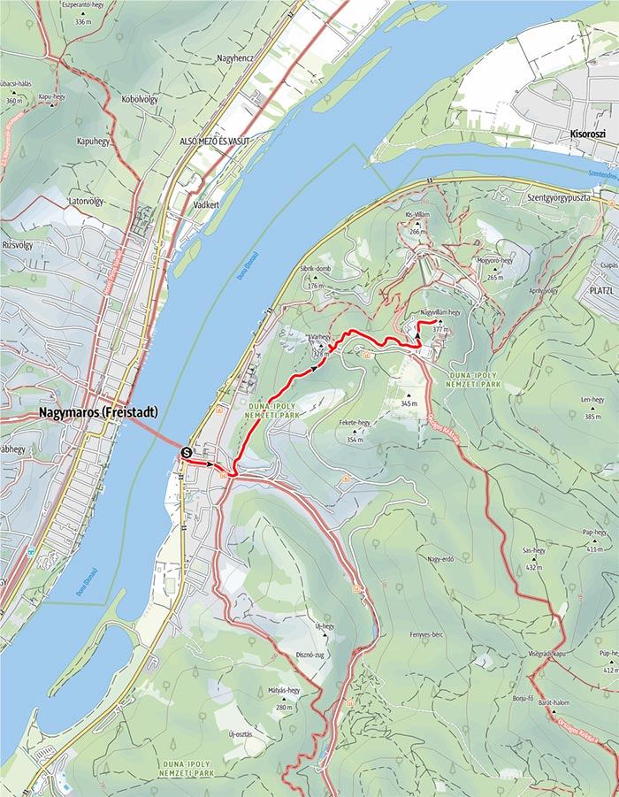
Source: termeszetjaro.hu tour planning app
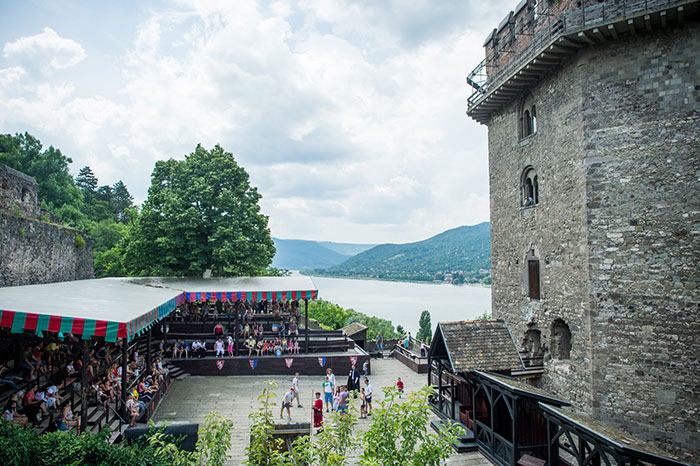
A Visegrad INFO office (about 200 metres from the ferry), follow the blue cross () or follow Fő Street in the direction of the Danube river to the Solomon's Tower towards. From the starting point, it is a pleasant 15-20 minute walk to the tower, so it is especially recommended for children and older people. The tower houses an exhibition on the history of Visegrad and the 14th century ornamental fountain of the Royal Palace. In the Solomon Tower, jousting tournaments are held from April to October.
A Solomon's Tower and the King Matthias Historical Playground is only open in high season, but the Royal Palace is open to visitors all year round. Please check the exact opening hours before visiting.
Hiking map: the Visegrád-Nagymaros ferry - Solomon Tower
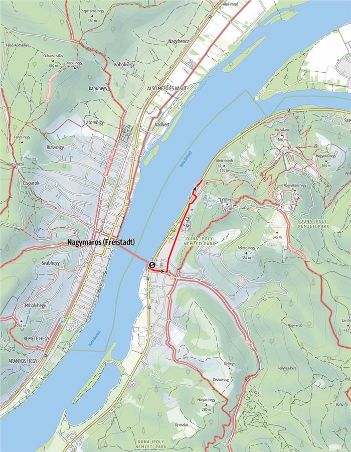
Source: termeszetjaro.hu tour planning app
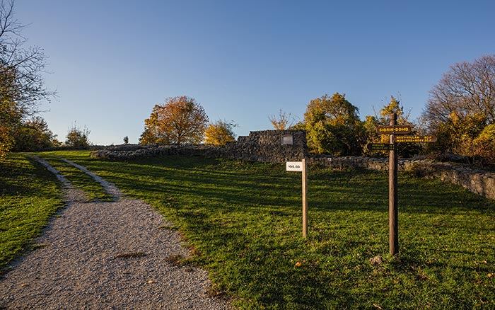
A From Visegrád-Nagymaros ferry the blue bar (), pass the Calvary and go up to the To the Citadel. If you do not see the Citadel, after about 100 m you will see the blue ruin ( ) for about 400 metres, then at the crossroads follow the blue cross right (in the direction of the ski slope). After approx. 500 m, the blue circle () to the Little Willam bus turn-off; the Wildflower Trail starts near the bus turn-off.
Leaving the tower on your left, you continue up the hill. The blue triangle (), go around the hill on the left hand side. Leaving the Jurta campsite, at the Mogyoróhegy restaurant, follow the blue triangle and the blue circle () for another 200 metres along the red T (). At the fork, follow the blue circle and after about 400 metres you reach the Little William Wildflower Trail starting point.
The trail shows the wildlife of the Little Willam and gives an insight into the history of human activity dating back to Roman times. At the end of the excursion, you can return to the ferry (with a detour to the Sibrik-dombon to the former Roman fortress or to the Royal Palace), or on the blue circle, followed by the blue rectangle (), switching to the Áprily Valley via Visegrád-Szentgyörgypuszta.
Hiking map: the Visegrád-Nagymaros ravine - Kis-Villám (Wildflower trail)
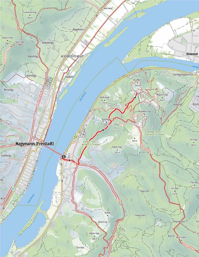
Source: termeszetjaro.hu tour planning app
Hikes of medium difficulty
for families with older children (at least senior school age), experienced hikers
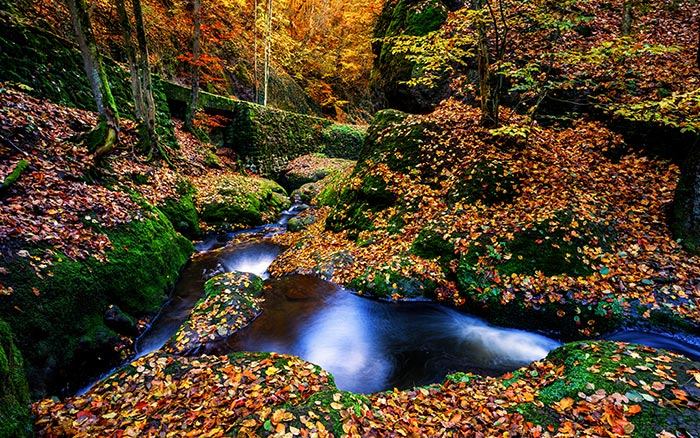
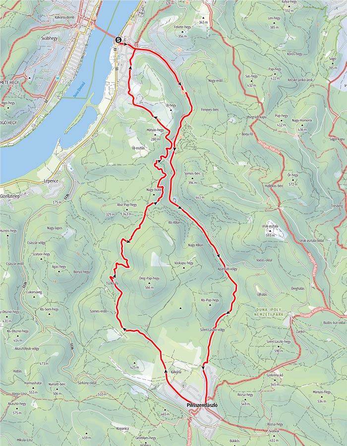
From Apátkúti Valley the easiest way to find the red bar from the ferry () is reached by following the sign. After about 3 km on the easy road, you first reach the Devil's Mill Falls and pass the Telgárthy gorge we arrive. Next to the meadow is the Bertényi Miklós Artist Garden, and the Mother Forest Nature Trail.
The red bar (), we pass the Kaán spring (water only at your own risk) and touch the first Zen temple in Eastern Europe, the Hoboji Zen temple. On entering Pilisszentlászló, the red lane and the green lane (); the latter takes you back towards Visegrád. The path is steep in places and slippery in wet weather, offering beautiful views towards the Danube. The green bar and the green cross (), follow the green lane towards Visegrád, the centre of which you will reach after about 2 km.
Hiking map: Visegrád - Pilisszentlászló - Visegrád (on the red and green lanes)
Source: termeszetjaro.hu tour planning app
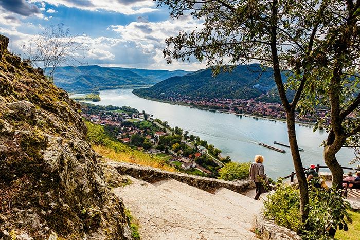
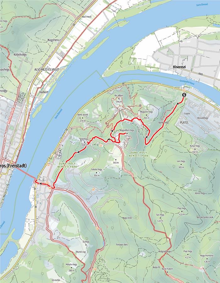
The tour starts from Visegrád-Szentgyörgypusztas, the From the Áprily Monument about 150 metres from the bus stop of the Volánbus. The first section is from Áprily Valley through the blue rectangle (), connected to the Rain-Fallow Nature Trail „The letter "T". After about 1.5 km we turn towards the mountain, after a short hike we reach the Jurta camp, where we visit the wildlife garden and the Mogyoró Hill trail. From the Jurta camp you can walk along the blue triangle () and the blue circle (), follow the signs across the ski slope to the summit of the Great Willam. Here it is worth going up to the To the Zsitvay Observatory, to try the Bobsleigh track, a Canopy pitch or the Big Villa Adventure Park.
Continuing along the road, now on the blue lane, after a few hundred metres you reach the Citadel where you can enjoy a wide range of exhibitions and programmes. The blue bar (), the road first passes the Calvary and then leads to the ferry.
Hiking map: Szentgyörgypuszta - Citadel - Zsitvay Lookout - Nagymarosi rév
Source: termeszetjaro.hu tour planning app
Long hikes around Visegrád
for experienced hikers, athletes, blue hikers, power hikers
The starting point of the tour is Leányfalu, which can be reached from Budapest and Szentendre by Volán. By car, it is recommended to leave the car in Leányfalu and then take the bus back from the end point, the ferry terminal. The red lane () starts from the bus stop near the Leányfalu, Pócsmegyeri rév bus stop. After about 1 km, leaving the built environment behind you, you reach the Vörös-kő (Red Stone) ridge on a steeper and steeper slope, from where you have a beautiful panorama towards Szentendrei Island and the Danube.
The green lane in the lobby of the Kis-Bük roof (), then cut out; follow the red lane to the Pálócki-rét, where you follow the national blue trail () we continue. The remains of the former missile base can still be seen at the Table of Lords. From the saddle of the Water Beat, there are alternating slopes and climbs to the saddle of the Great Fork. A Great-Villamra climbing up, the blue triangle () on the To the Zsitvay Observatory we arrive. Returning to the blue lane, you soon reach the To the Citadel which should not be missed under any circumstances. From here the sign leads to the ferry, from where you can take the ferry to Nagymaros (train) or the bus to Esztergom or Leányfalu/Budapest.
Hiking map: Leányfalu - Vörös-kő - Urak asztala - Nagy-Villám - Nagymarosi rév
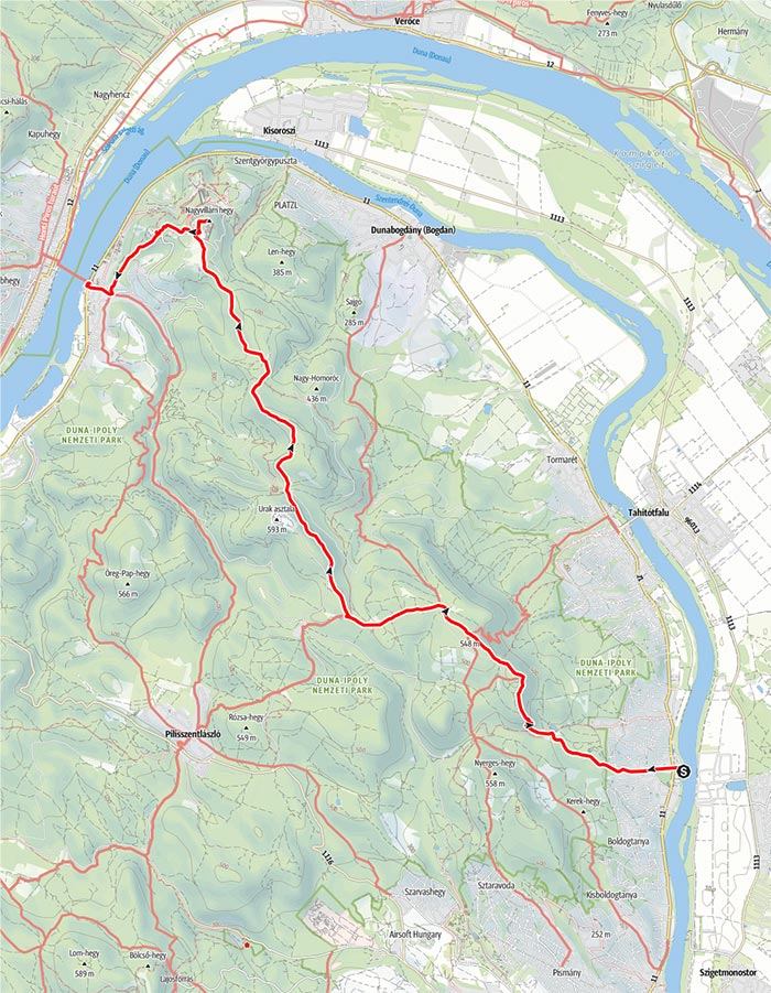
Source: termeszetjaro.hu tour planning app
The starting point of the tour is Dömös, which is most easily reached by bus from Budapest or Esztergom. Our tour starts from the centre of Dömös on the red lane (), which is briefly separated by a yellow and a green bar ( ), heading south along the Mill Valley. A At the Chapel of the Holy Tree the red triangle (
 ) and take the steep climb to the On the Wilderness Stones through the For the pulpit we go up. The lookout tower, inaugurated in 2016, offers views of the Danube Bend and Börzsöny. The red triangle meets the red cross (
 ); at the fork, follow the red cross, which takes you to Pilisszentlászló after about 3.5 km.
Pilisszentlászló on the red lane (), you will first reach the St. László and then the To Apátkúti Valley, passing the Devil's Mill Falls in addition. The valley is a popular spot for Telgárthy's Ridge, located near the With Miklós Bertényi Füvészkert. After leaving the meadow, the red lane leads to Visegrád, then to the blue lane in the centre () to approach the Citadel. The blue ruin (), followed by the blue cross () on the Solomon Towers we reach the end point, the anchorage.
Hiking map: Dömös - Wild Standing Stones - Preaching Chair - Pilisszentlászló - Nagy-Villám - Citadel - Solomon's Tower - Nagymaros Rév
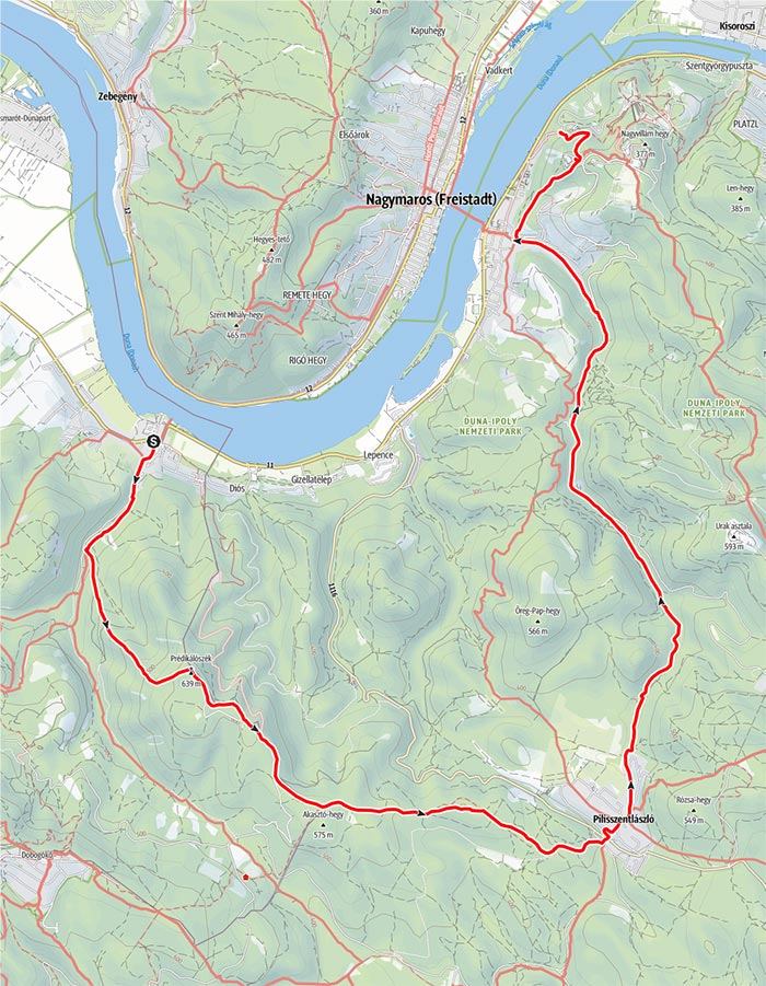
Source: termeszetjaro.hu tour planning app
The starting and end point of the tour is the Visegrád-Nagymaros ferry. The red lane starting from here () we leave the village. The Apátkúti Valley is a popular point of Devil's Mill Falls, and about 300 metres from the Telgárthy's Ridge, located near the With Miklós Bertényi Füvészkert.
Leaving the meadow, take the red lane after about 1.5 km to the To the Kaán source The landscape becomes wild and then gradually tames; on the way we pass the Hoboji Zen temple. On entering Pilisszentlászló, the blue lane () and turn east. Going around the Szent László hill, we reach the Pap and then the Pálócki cirque; the remains of the former missile base can still be seen at the Table of the Lords. From the saddle of the Water Beat to the saddle of the Great Willam, the blue triangle () on the To the Zsitvay Observatory and then return to the blue lane to reach the To the Citadel. From here the blue sign leads to the ferry, from where you can take a ferry or bus.
Hiking map: Nagymarosi rév - Apátkúti valley - Pilisszentlászló - Nagy-Villám - Fellegvár - Nagymarosi rév
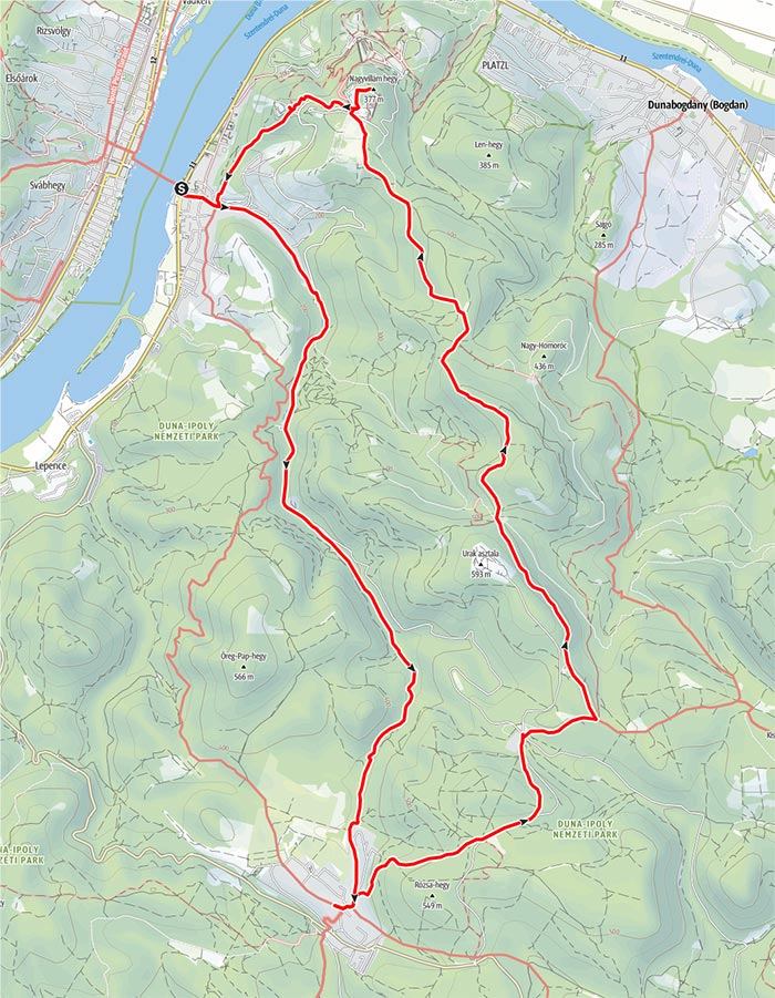
Source: termeszetjaro.hu tour planning app
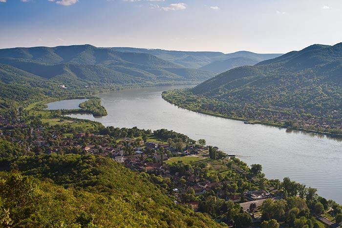
Section 16 of the National Blue Route passes through Visegrád. There are three stamping points in the town: one each at the Zsitvay Lookout and the Nagy-Villám restaurant, and at the ferry at the harbour driveway at the section boundary.
Among the attractions close to the tour route, we particularly recommend Zsitvay Lookout, as well as the Citadel to view. A shorter detour is available at Solomon's Tower, as well as the Royal Palace is. The former is open seasonally, the latter also in winter.